The Malaysian Meteorological Department has activated severe weather alerts across a broad swathe of the country, warning residents of intense thunderstorms accompanied by torrential rain and gusty winds. The alert, which remains in effect until 1 am on June 19, encompasses multiple districts spanning both Peninsular Malaysia and the East Malaysian states, signalling a significant atmospheric disturbance affecting the region's weather patterns.
On the peninsula, the northern state of Kedah faces heightened weather risks across three districts: residents and travellers in Padang Terap, Sik and Baling should remain vigilant for rapidly developing storm conditions. Similarly, the eastern corridor experiences considerable exposure, with Kelantan particularly vulnerable given the warning's coverage of five districts—Tumpat, Pasir Mas, Jeli, Tanah Merah and Kuala Krai—which stretch across the state's geography. Perak's Hulu Perak region in the north also falls within the warning zone, whilst Pahang's inland Jerantut district has been flagged for potential severe weather.
Sarawak, Malaysia's largest state, faces particularly extensive impacts given the warning's geographic spread. The affected areas extend from the state capital and surrounding regions—Kuching, Serian and Samarahan—through the central divisions including Sri Aman, Betong, Sarikei and Sibu, to the northern divisions encompassing Kapit, Bintulu, Miri and Limbang. This comprehensive coverage reflects the pervasiveness of the atmospheric system, which has not localised to any single region but rather distributed itself across multiple climate zones and geographical features throughout Sarawak.
In Sabah, the warning applies to scattered districts across the state, with the Interior division's Kuala Penyu, the West Coast region including Putatan and Ranau, and the eastern Sandakan division covering Telupid and Beluran all placed under alert. The federal territory of Labuan, situated off Sabah's coast, has similarly been included in the warning envelope. This distribution across three distinct Sabah regions indicates that the weather system is not confined to any particular coastal or inland area but rather encompasses the state broadly.
Thunderstorm warnings of this scope typically emerge when atmospheric moisture convergence reaches critical levels, often triggered by inter-monsoon transitions or the collision of wind systems across Malaysia's diverse topography. The inclusion of both peninsula and Borneo territories suggests a large-scale pressure pattern is driving the instability rather than isolated local heating effects. For residents across these regions, the practical implications are straightforward: periods of heavy downpour may lead to localised flash flooding, particularly in low-lying areas and near drainage systems already saturated by recent precipitation. Strong wind gusts associated with thunderstorm cells can pose hazards to unsecured structures, outdoor installations and vehicles traversing exposed routes.
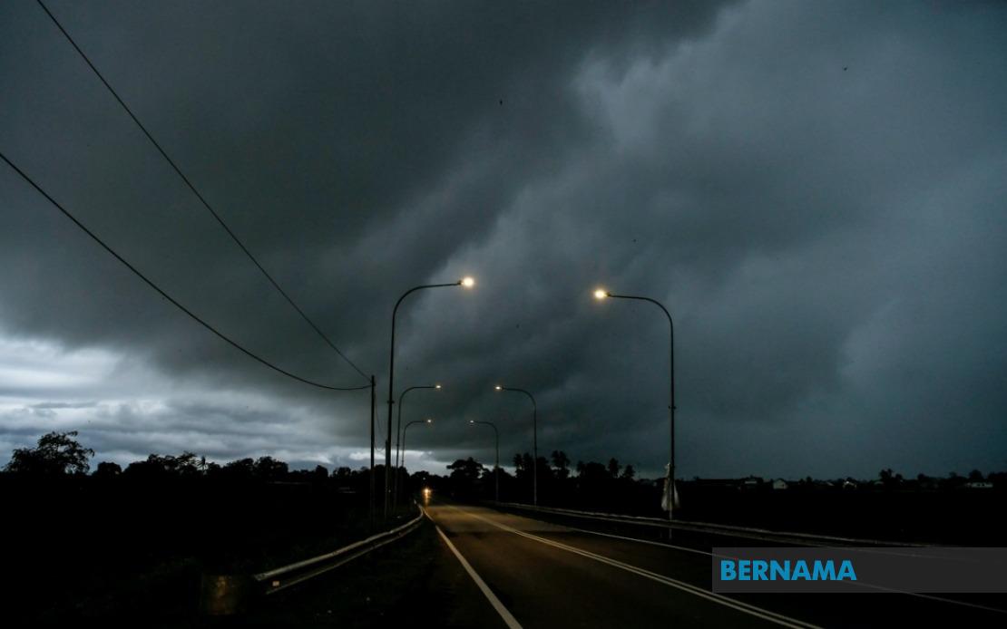
The temporal window extending until 1 am represents a critical overnight period when visibility diminishes and emergency response capabilities face practical constraints. Travellers contemplating journeys through the affected districts should weigh the meteorological risks against journey necessity, with particular caution warranted for those driving on main routes that may become treacherous during intense rainfall. Electrical safety likewise becomes paramount given the thunderstorm warning, with residents advised to minimise exposure to electrical equipment and avoid unnecessary outdoor activities during peak storm hours.
For agricultural stakeholders, particularly in rural districts across Kelantan, Perak and interior Sarawak, the heavy rainfall forecast carries mixed implications. Whilst moisture benefits growing crops during appropriate seasons, the intensity and concentration of rainfall over a condensed timeframe creates risks of soil erosion, crop lodging and waterlogging in poorly drained fields. Aquaculture operations and fish farming facilities may similarly face complications if water levels rise excessively or quality parameters shift due to heavy freshwater influx.
The meteorological alert system represents Malaysia's ongoing commitment to public safety through advance warning dissemination. By identifying specific affected districts rather than issuing blanket state-wide warnings, MetMalaysia enables residents and authorities to calibrate responses proportionately and focus preparedness efforts where atmospheric risk concentrates most acutely. This granular approach contrasts with broader warnings and reflects improved forecasting precision.
Southeast Asian tropical weather patterns frequently generate such multi-state severe weather episodes, particularly during transitional monsoon periods when competing wind systems create atmospheric instability. Malaysia's geographic position and complex terrain—encompassing coastal plains, interior highlands, and island territories—create ideal conditions for thunderstorm development when atmospheric conditions align. Understanding these patterns helps residents and planners anticipate seasonal vulnerabilities and implement appropriate preparedness measures across different regions.