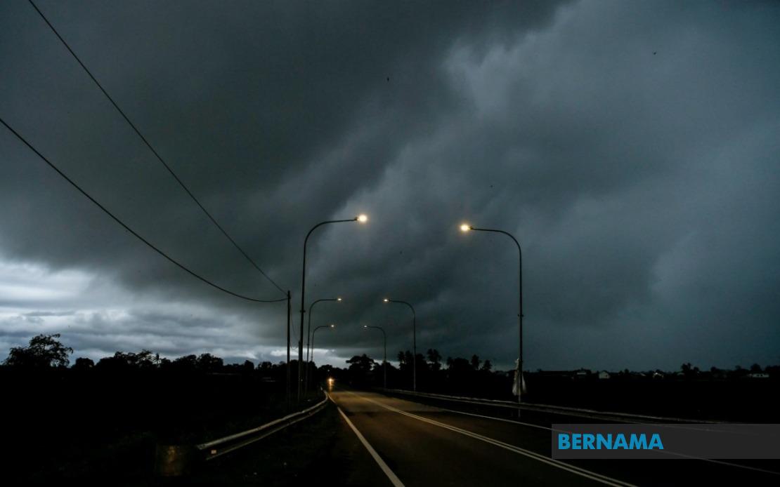
The Malaysian Meteorological Department has expanded its severe weather alert to encompass nine states and Labuan, cautioning residents and commuters to prepare for potentially hazardous atmospheric conditions persisting until early evening. The advisory, released on June 18, signals heightened weather instability across much of the country, with particular emphasis on thunderstorm activity coupled with intense precipitation and elevated wind speeds.
In the northern region, the entire state of Perlis faces the full brunt of the warning, while Kedah experiences targeted alerts concentrated in the administrative districts of Langkawi, Kubang Pasu, Kota Setar, Pokok Sena, Padang Terap, Sik and Baling. Perak's exposure centres on the Kerian, Larut, Matang and Selama, Kuala Kangsar, Kinta and Kampar municipalities, indicating that both rural highlands and populated lowland areas remain vulnerable to the forecasted weather system.
Moving southward through the peninsula, the forecasters have identified risk zones in Pahang including the high-altitude Cameron Highlands together with the lower-lying districts of Bentong, Bera and Rompin, suggesting the storm system possesses both vertical and horizontal reach. Selangor's warnings concentrate on the Hulu Langat district, which encompasses areas stretching from the state capital towards the interior, whilst Negeri Sembilan's alert zones span Jelebu and Jempol. The southern state of Johor faces concurrent warnings across Segamat, Kluang and Mersing, indicating that the weather disturbance extends across the broader southern peninsula.
East Malaysian states encounter similarly extensive threats. Sarawak's affected districts represent a substantial portion of the state's populated regions, encompassing the capital Kuching with its immediate satellite towns of Bau, the district of Serian, Samarahan with its subdivisions including Asajaya, the Sarikei district's Meradong area, and the central regions including Sibu, Mukah's Tanjung Manis locality, Kapit with its component areas of Song and Kapit proper, Bintulu's Tatau and Sebauh subdivisions, as well as the northern zones of Miri covering Marudi and the isolated division of Limbang.
Sabah's alert encompasses three distinct geographical zones reflecting the state's varied topography. The interior highland regions of Sipitang, Kuala Penyu, Beaufort and Tambunan face warnings, alongside the densely populated west coast corridor. The east coast Sandakan division experiences the alert limited to the interior districts of Tongod and Kinabatangan, indicating meteorologists have identified particular vulnerability zones based on prevailing atmospheric patterns and local terrain effects.
Thunderstorm warnings of this geographic magnitude typically reflect significant atmospheric instability driven by seasonal monsoon patterns or collision between opposing air masses. For Malaysian residents and businesses, such alerts carry practical implications spanning transportation disruptions, particularly affecting flights and maritime activities, potential power interruptions in affected zones, and hazards associated with flash flooding in low-lying areas and near watercourses. The specificity of the district-level warnings enables local authorities to concentrate resources and coordinate emergency response protocols more effectively.
Commuters across the affected regions should exercise heightened caution, as thunderstorms commonly bring sudden wind gusts capable of destabilising vehicles, particularly high-sided commercial transport. Pedestrians and cyclists face elevated risk from lightning strikes, necessitating avoidance of exposed areas and tall structures during peak storm activity. Drivers should anticipate reduced visibility from heavy downpours and exercise defensive driving techniques.
For agricultural sectors in the warned areas, the forecasted precipitation offers mixed consequences. Whilst substantial rainfall benefits water reserves and crop irrigation cycles, the associated strong winds and lightning pose threats to standing crops, horticultural operations, and outdoor agricultural structures. Farming communities in the highlands of Cameron Highlands and coastal agricultural zones warrant particular caution.
The temporal constraint—with warnings effective until 9 pm—suggests meteorologists expect the system to weaken or shift by late evening, though residents should monitor official updates from MetMalaysia for potential extension or intensification. Such concentrated alerts underscore Malaysia's sophisticated weather monitoring capabilities, enabling authorities to issue geographically refined warnings that balance public alarm against practical operational guidance. As the alert period concludes, follow-up assessments will likely evaluate rainfall totals, wind speed measurements, and any reported incidents to refine forecasting models for future events.